
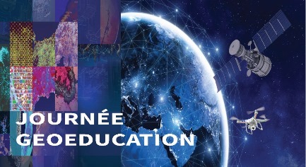
The “GEO-SPATIAL DAY” is a symposium on GEO-EDUCATION AND GEO-SPATIAL DEVELOPMENT. It was organized by IEEE INSAT IAS SBC in partnership with AGEOS; the African Association of Geo-spatial Development.
IEEE IAS INSAT SBC believes in being open to the national scientific associations ecosystem. Therefore they try to provide their members with diverse activities and events. In fact, they always push the boundaries when it comes to encouraging their members to up to date on the latest technological developments.
What are the objectives of this “GEO-SPATIAL DAY”?

The “GEO-SPATIAL DAY” consisted of a series of conferences revolving around geo-spatial development, the 24 participants, comprised of both IEEE and Non-IEEE Members, whose backgrounds range from chemical and biological engineering to automation and industrial maintenance, would have the opportunity to learn about the various technologies used in the analysis, processing and presentation of geographical data and discuss the use of spatial information as a vector for development.
What kind of lectures were included ?
The four lectures revolved around multiple topics, namely:
-
The projects and objectives of the African Association of Geo-spatial Development (AGEOS):

Mrs. Nesrine Chetata is a senior Lecturer at Bordeaux INP and President of the African Association of Geo-spatial Development (AGEOS).
During a 20-minute keynote, she introduced the nature, scope and main goals of the association. Also she mentioned some of its latest projects and achievements in geospatial technology, such as the effective implementation of geospatial data for cartographic and web mapping.
-
The import of geographic data through drones:
Where Mrs. Chetata, after giving a generalized introduction to drones and sensors, proceeded to explain the use of drones in agriculture, security and many other promising fields. The attendees got the chance to see how drones can be used as a helpful tool rather than a source of concern and privacy violation. The lecturer also provided an industrial perspective on the use of drone and geo-spatial technologies; most notably the challenges faced in the industrialization of drones, the integration of new technologies such as IoT, image processing, AI… and its effects on drone autonomy. She then went on to describe the energetic challenges of drone technology, such as short flight duration due to battery size, and the potential use of renewable energy as a solution to that problem.
-
The integration of artificial intelligence technologies in nano-satellites:

Presented by active African Association of Geo-spatial Development (AGEOS) member and Nvidia Deep Learning Institute ambassador, Mr. Bilel Khalifa, who walked the attendees through the basic concepts of deep learning and artificial intelligence, then proceeded to explain the role of embedded application-oriented computers, particularly Nvidia’s powerful Jetson Nano, in making satellites more accessible to the public.
After that, the lecturer introduced the notion of CubeSats. Also he gave some insight regarding NASA’s CubeSat Launch initiative and its procedures. Mr. Khalifa was keen to answering every question and explaining the functionality of artificial intelligence in improving satellite technology in the highest degree of clarity and accuracy.
-
The Mars Human Expedition:

During this presentation, the Tunis Science City main scientific mediator, Mrs. Imen Titouhi, gave general information on the different properties of Planet Mars: weather conditions, planetary cycle… then proceeded to demonstrate the history behind some of the most important rover expeditions to Mars, such as ‘Opportunity’.
The lecturer followed up by providing the attendees with a walk-through. It concentrated on the different protocols implemented during a human mission to mars, such as the measures taken during the launch, the selection the optimal flight trajectory and the landing process.
The speaker also demonstrated, through a simulation, the different procedures implemented post-landing. For example setting communications with earth, performing regular biomedical check-ups and decontamination, installing temporary headquarters, and much more.
Great announcement at the end of The “GEO-SPATIAL DAY“
The Symposium was concluded by the announcement of The ActInSpace and GeoData Hackathons. Participants would tackle different contemporary geo-spatial Problems and situations and provide solutions through computer programming, followed by a coffee break, an a networking session.
For more information, please feel free to check their social media accounts :
Website , Facebook Page , Instagram , Twitter , Linkedin
Social Media